
Satellite Data
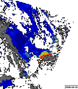
Graphic representation of an algal bloom development in the German Bight based on satellite data.
In the Department of Remote Sensing, selected satellite images are archived for scientific work.
Using the SCENE-FINDER, satellite images within a chosen year can be selected according to the following criteria:
- Resolution
- Processing level
- Type of processor
- Orbit No.
- Day
- % of water pixels in the image
- % of cloudless water pixels in the image
- % of cloudless pixels in the image
- Geographical position within the image
- Image location on the globe
MERIS, ASAR and MODIS measurement instrument data are available.
Note: Only JPG images can be accessed from outside the Department of Remote Sensing.
End of Mission for ENVISAT
The ENVISAT satellite mission with the MERIS observation instrument was unfortunately abandoned in May 2012 by the European Space Agency (ESA) after attempting to regain contact with the spacecraft for a period of one month to no avail. This means that we can no longer provide near real-time data here. Please visit the Homepage of the ENVISAT mission.
We are presently working toward providing images from other ocean colour satellites on this page.