Temperature and Salinity
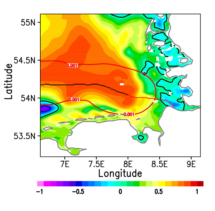
Automated FerryBox systems provide valuable information on the spatial distribution of sea surface temperature (SST) and salinity (SSS) in the North Sea. In order to obtain a two dimensional picture of SST and SSS the observations taken along ship tracks are extrapolated to larger areas using additional information from numerical models. For example, data from the route Cuxhaven-Immingham are assimilated into a three-dimensional circulation model. An assimilation step is performed every 24 h. The output is validated against an independent data set (the MARNET Deutsche Bucht station). Misfits of SST and SSS in the free run are corrected almost completely after data assimilation. FerryBox data can locally enhance SST fields of the German Bight (up to ± 40 km apart from the track).

COSYNA Product: Temperature and Salinity. Skill of the SST data assimilation (in best case skill =1). The red line indicates the area beyond which the influence of FerryBox observations was reduced with a filter to avoid unrealistic SST fields.
