“Correctly classifying the strength of a storm”
When a severe storm sweeps across Germany, many people wonder if climate change is to blame. In the future, the HZG’s new Storm Monitor website storm-monitor.eu will answer this and other questions. Dr Oliver Krüger explains in an interview what additional information the Storm Monitor provides and who could be using it in the future.

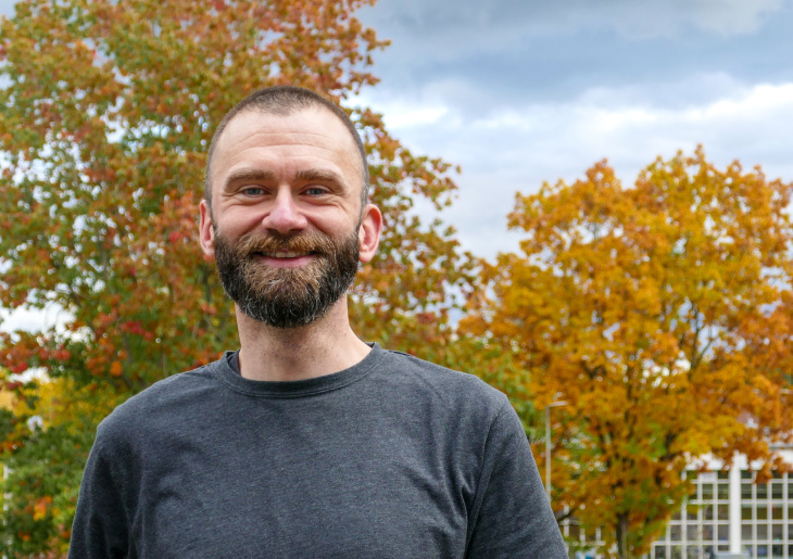
Dr. Oliver Krüger works at the HZG Institute of Coastal Research. Photo: HZG/Gesa Seidel
Dr Krüger, HZG’s new Storm Monitor went online a few days ago. Why is it important to assess how strong a current storm is?
For years we have been increasingly asked by journalists during a storm event whether the event is still considered normal or should be ascribed to climate change. The Storm Monitor compares a currently occurring storm with storm data from the past seven decades. Using this tool, a storm can now be classified at a glance for the first time. A surprising result for many journalists is that today’s storms are by no means always stronger than they were before. The intensity of storms was, for example, considerably higher in the 1980s and the early 1990s.
Who else benefits from the new website?
Basically, any person interested in the weather, especially in storms. When there is a strong storm, for example, my family often asks whether it is particularly severe. The topic is of interest to many people, especially in northern Germany. The Storm Monitor can now answer questions such as: “Is the current storm still in the normal range or is it due to climate change?” The Storm Monitor of course also serves government authorities responsible for the safety of citizens and for disaster control. In the future we also wish to make the seventy-year time series publicly available. We have already been in contact with reinsurance companies that want to use the data to carry out their own risk and damage calculations. We are curious to see who will use the Storm Monitor in the future and for what purposes.
The HZG has already been making the Storm Surge Monitor available for some time now. How did the Storm Monitor come about?
Two years ago the Helmholtz Association, to which the HZG belongs, started a climate initiative in which the various Helmholtz centres intensified research across centres on the topic of climate change. In our Coastal Climate research group, we came up with the idea of adding a Storm Monitor to the Storm Surge Monitor, which has been operated by the HZG for quite a while now. The Storm Monitor is based on research for calculating storm activity that had already been developed in the 1990s within Hans von Storch’s working group here at the institute. I have continued this research on what is known as “geostrophic wind" and now, with the help of my master’s student Daniel Krieger, I have built the Storm Monitor website based on this theoretical foundation.
The Storm Monitor provides various information. What should users expect here?

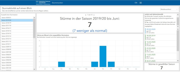
Various aspects can be selected in the storm monitor dashboard. On this screenshot you can see that in the 2019/2020 season 7 storms occurred in the region of Central Germany. The monitor shows that this is 7 storms less than the long-term average of 14 storms per season. This means that the number of storms is significantly lower than in the past years. Screenshot: storm-monitor.eu
Wind speed comparisons for the current storm situation with the long-term development should be particularly interesting. Visitors to the website can also see how many storms there have been over the current season or in the past month and to what extent the number deviates from the long-term trend, whether the number is lower or higher. Furthermore, the website contains many basics about wind as a topic and the calculation of wind speeds. It thus offers individuals who are not familiar with the subject an easy introduction to storms.
You studied meteorology and initially worked on climate forecasting at the Max Planck Institute for Meteorology in Hamburg. How did you arrive at the topic of storms and wind?
The wind, or the weather in general, always interested me. I grew up on a farm in Brandenburg—the topic of weather is very important there because you depend on it. When I was sixteen, I had fun taking my own daily weather measurements, entering the temperatures and precipitation in a log book. When I was at the Max Planck Institute, I met Hans von Storch at some point. He asked me whether I wanted to write my doctoral thesis on the calculation of wind speeds using air pressure data—a method he had developed together with colleagues from the German Weather Service. I then validated and refined the method in my doctoral work. One very lovely outcome has been the Storm Monitor.
The interview was conducted by Tim Schröder.
Further Information
Press Release "Is it just a storm or is it climate change?" (28.10.2020)
Contact
Institute of Coastal Research
Phone: +49 (0)4152 87-1559
E-mail contactWebsite
Helmholtz-Zentrum Geesthacht
