Numerical Modelling
Different models are used to simulate currents in the ocean as well as water level, temperature and salinity. The wave model WAM calculates the wave distribution and predicts the height and period of wind waves. In the moment we are working on the coupling of a current model with a wave model. Also biogeochemical models are subject of research in the department.
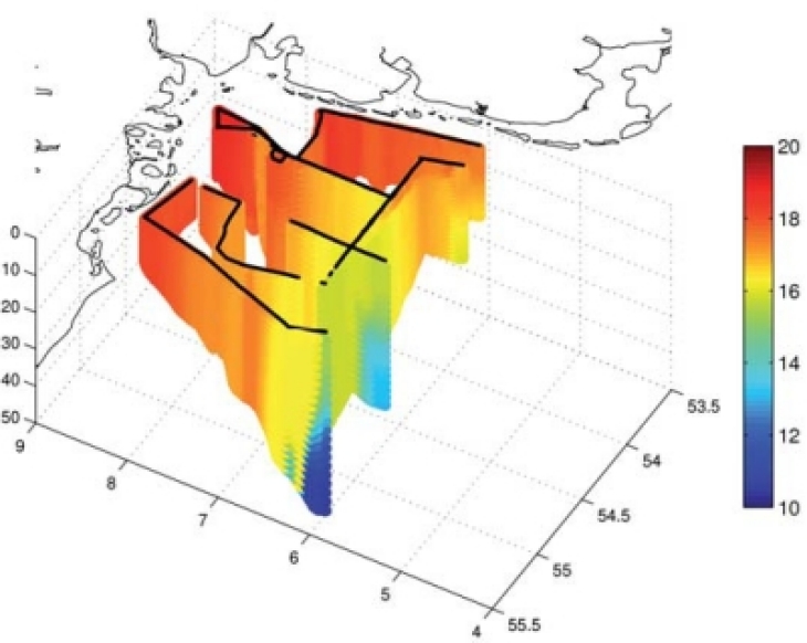
Different models calculating water level, currents and other parameters are used in our department for various issues. The current model GETM, for example, provides continuous forecasts of current, temperature and salinity for the German Bight. The data are available in the COSYNA data portal.
HIROMB BOOS, NEMO and SELFE are other circulation models we are using in the group for our reseach. More information is available below.
Current Model GETM
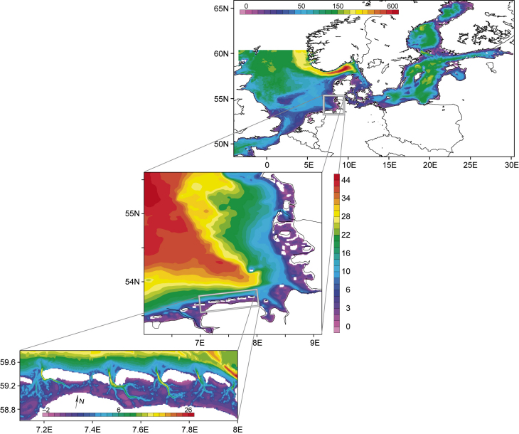
The nested-grid pre-operational circulation model consists of three model configurations:
(1) Coarse-resolution outer model for the North Sea-Baltic Sea (grid size about 5 km),
(2) fine-resolution inner model (grid size about 0.8 km) covering the German Bight,
(3) very fine resolution model for the Wadden Sea region (grid size about 200 m) resolving the barrier islands and the tidal flats.
Based on this model a shortterm forecast (1 - 2 days) of currents, temperature and salinity is provided for the German Bight and the Wadden Sea. The results of hindcast and forecast are continuously published in the COSYNA data portal.
COSYNA Data Portal
HIROMB BOOS Model (HBM)
HIROMB BOOS is a high resolving operational model of the Baltic Sea. It provides forecasts for different physical parameters such as water level, currents, temperature, salinity and ice information.
The model is performed by the Swedish Meteorological and Hydrological Institute (SMHI) in cooperation with other institutions in the Baltic Sea area.
NEMO (European Modelling of the Ocean)
The model was used a.o. for investigations of tides in the North Sea.
SELFE Hydrodynamic Model
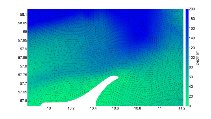
SELFE unstructured grid around the northern tip of Denmark mainland. Graphics: Hereon/ S. Grashorn
SELFE is a hydrodynamic model based on an unstructured grid. We work with a coupled model of the North and Baltic Sea to investigate e.g. a storm surge taking place in December 2013.
Different wave models are developed in our group. They are used worldwide. More information on selected models you may find further down.
- Wave model (WAM), most recent version 4.5, developed in a consortium
- Hybrid Parametric (HYPA) Deepwater wave model
- HYPAS Shallow water version of HYPA
- a de-coupled stationary high resolution wave refraction model taking into account bathymetry and currents (Ray-Model)
- a wave prediction model for coastal areas (K-model)
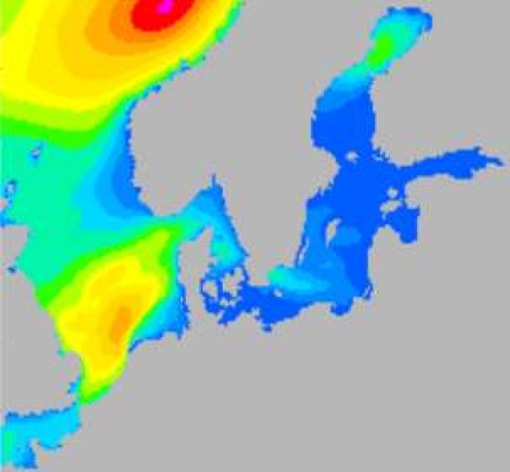
WAM Cycle 4.5.4
Graphics: Hereon/ Arno Behrens
A Wave Prediction Model for Global and Regional Scales
Basic characteristics:
The WAM model is:
- a 3rd generation non-stationary surface wave prediction model
- based on the energy density balance equation
- in frequency – direction coordinates,
- and was developed for large (i.e. global scale, North Atlantic, Pacific) and medium scale (Mediterranean, North Sea, Baltic, Great Lakes) deep or shallow water applications and is able to consider stationary currents and ice coverage. Multiple nesting is possible.
The model is forced by time series of:
- wind fields at 10 m above sea surface,
- wave spectra at open boundaries,
- currents and water level fields.
WAM computes the 2d wave variance spectrum through integration of the transport equation. The source function is represented as a superposition of the wind input, white capping dissipation, nonlinear transfer, bottom friction and wave breaking. The output provides wave information of total sea, wind waves and swell.
Example
Graphics: Hereon/ Arno Behrens
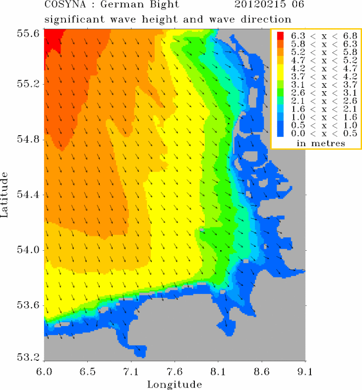
The forecasts of the WAM model are integrated in the COSYNA data portal. The picture shows a snapshot of significant waveheight and wave direction in the German Bight, 15 February, 2012, 6 hrs.
A Stationary Wave Refraction Model (Ray model)
Basic characteristics:
The Ray model is
- a de-coupled stationary high resolution spectral surface wave model
- based on the action balance equation and the reverse ray theory of Abernethy & Gilbert
- in wave frequency – direction coordinates
- with high resolution (directional resolution typically 1° and 25 frequencies )
and was developed for applications where depth and/or current refraction play a significant role in changing the propagation direction, wave length , wave period and energy content of waves.
The model is applied for a single point of interest. By repeating the calculations for different points it is possible to generate a map of wave information.
The model is forced by:
- wind fields at 10m above sea surface,
- currents and water level fields,
- wave spectra at open boundaries.
Example 1
Graphics: Hereon/ Gerhard Gayer
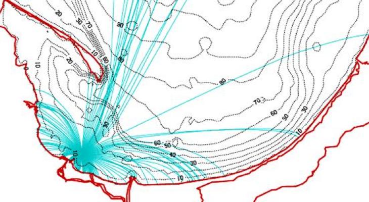
Refraction rays for a wave frequency of 0.08 Hz for a point of interest in the bay of Gdansk (Baltic Sea) due to depth (contour lines) refraction. In this example we were able to explain measured wave spectra showing 2 peaks, both with a mean direction to the south. The peak at lower frequencies was due to long waves coming from the Baltic Sea. The second peak at higher frequencies was due to waves generated off the western coast inside the bay, first travelling to the east, then turning to the south.
Example 2
Graphics: Hereon/ Gerhard Gayer
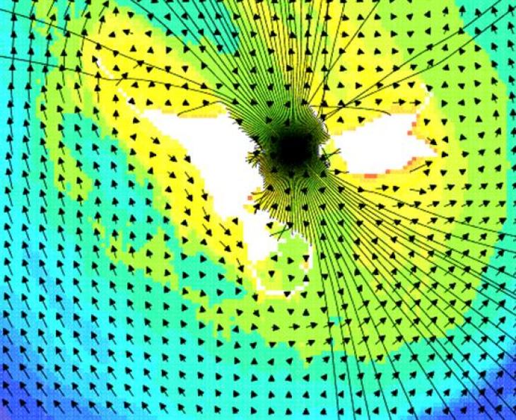
Refraction rays for a wave frequency of 0.3 Hz for a point of interest between the islands of Helgoland, located in the German Bight of the North Sea, which is mainly influenced by current (vectors) and depth (color coded) refraction.

