Improved Forecasts for Surface Currents
Scientists from the Institute of Coastal Research at the Helmholtz-Zentrum Geesthacht are introducing a new data analysis method that enables more precise surface current estimates in the German Bight. The details will be published in the Journal of Atmospheric and Oceanic Technology. The work stems from a co-operation with the Institute of Oceanography at the University of Hamburg. This method particularly improves planning measures in the event of disasters.

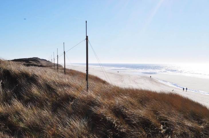
HF-Radar on the island of Sylt. Photo: HZG/Jochen Horstmann
To date, surface currents have essentially been analysed with mathematical models. Due to limited data availability, verification to which extent the models supplied correct results could seldom be achieved. That situation changed when the Institute of Coastal Research at the Helmholtz-Zentrum Geesthacht installed three of what are known as high-frequency radar instruments in the German Bight. These installations on Wangerooge and Sylt as well as in Büsum are part of the COSYNA measurement system.
Radar system with high temporal and spatial resolution
The radar system used in COSYNA consists of three antenna stations on the islands of Wangerooge and Sylt as well as on the mainland in Büsum. “The radar transmits with a frequency of about twelve MHz and makes use of the Doppler effect to obtain information about current directions and velocity from the backscattered signals. The devices supply information on the surface currents with high spatial and temporal resolution,” explains Dr. Jörg Seemann from the Department of Radar Hydrography at the Helmholtz-Zentrum Geesthacht. The individual antenna stations have a range of approximately one hundred km and therefore cover large areas of the German Bight.

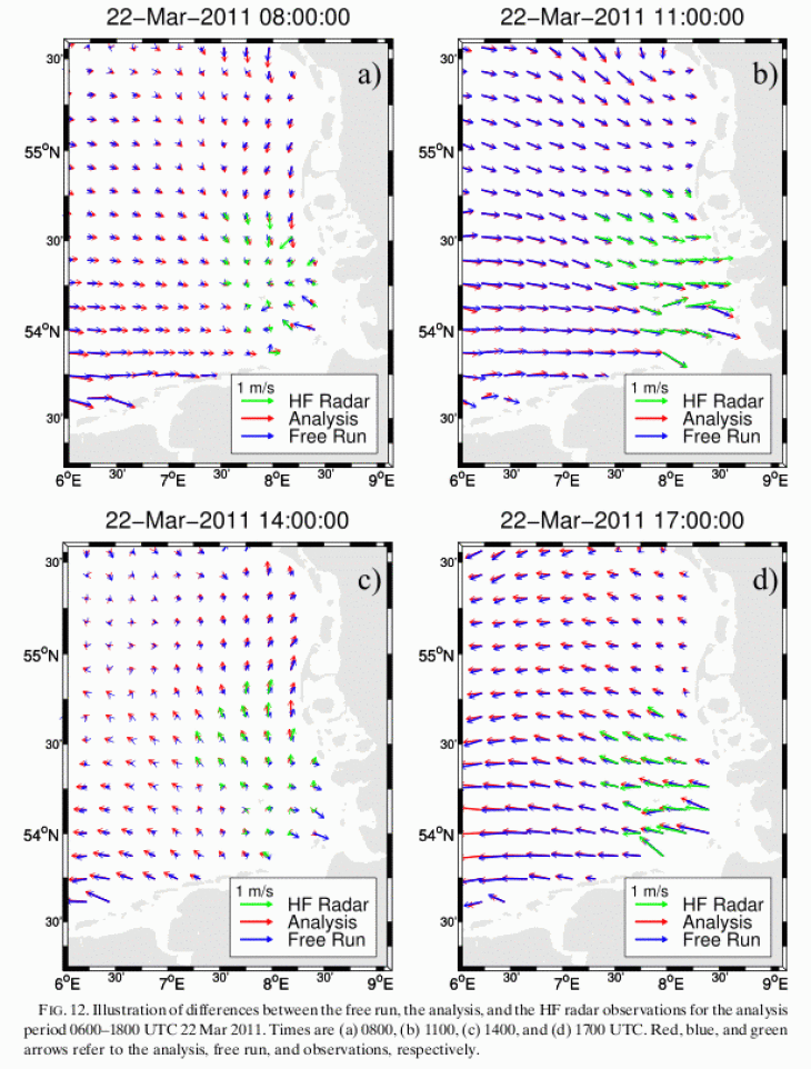
Illustration of the complexity of the tidal currents during a cycle of 12 hours
The new method presented in the Journal of Atmospheric and Oceanic Technology combines the analyses of the numeric models with data from the high-frequency radar devices, thus improving predictions, particularly of short-term developments of the current fields in the German Bight for the subsequent twelve hours. “The currents in the German Bight are propelled by both tides and wind. Forecasts are challenging due to the complicated shape of the coastline and the structure of the sea floor,” says Johannes Schulz-Stellenfleth from the Department of Data Analysis and Data Assimilation, led by Prof. Emil Stanev.
Saving lives through more precise current estimates
In practice, such information is essential when reacting to oil disasters or for rescuing castaways. The more precise the currents can be estimated, the more a rescue team can target their response in reacting to a disaster, thus reducing the negative impact.

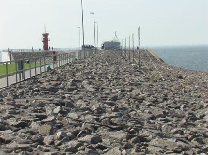
Antenna station in Büsum. Photo: HZG
“In determining the position of drifting objects on the sea surface, relatively small errors in current estimations can lead to substantial local deviations. These errors must be minimised for many practical applications,” says Emil Stanev. One example of such an application would be during a “Search and Rescue” (SAR) mission, where a person drifting in the water after a shipping or offshore platform accident must be saved. The method presented in the article has since been integrated into the COSYNA forecast system and the respective current fields are freely available on the COSYNA website. The COSYNA Webseite
The article is published in the February edition of Journal of Atmospheric and Oceanic Technology, Vol. 32, No. 2, pages 256-281. Article in the Journal of Atmospheric and Oceanic Technology
Contact
Director of Data Analysis and Data Assimilation
Institute of Coastal Research
Phone: +49 (0)4152 87-1597
Helmholtz-Zentrum Geesthacht
Data Analysis and Data Assimilation Scientist
Institute of Coastal Research
Phone: +49 (0)4152 87-1511
Helmholtz-Zentrum Geesthacht
